
(click to enlarge)
Author: sharpsjohn
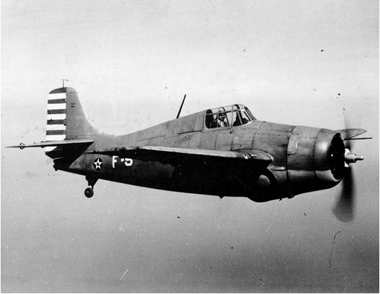
Grumman F4F Wildcat & TBF-1 Avenger
F4F Wildcat and TBF-1 Avenger

(click to enlarge)
Collision Details:
Date: August 17, 1942
- 4 Grumman Avenger bombers making simulated group torpedo run on Meydenbauer Bay, Lake Washington
- 3 Wildcat fighters attempting to oppose run
- 1 Wildcat held his attack too long
- Mid air collision between 1 Wildcat and 1 Avenger; both aircraft crash and sink
- Avenger Pilot, Radioman Injured, Tail Gunner Killed
Operating out of NAS Seattle at Sand Point, four Avenger torpedo bombers made a simulated torpedo attack on a target in Lake Washington, located near Meydenbauer Bay.
Three Wildcat fighters were simulating defense of the target.
The torpedo bombers were traveling east, toward Bellevue, at about 200 knots. The three fighters made an opposing run from ahead at about 300 knots. The pilot of one Wildcat held his attack too long to affect a safe recovery and collided with one of the Avengers. The fighter pilot continued west, toward Seattle, lowered his landing gear to slow his plane and bailed out. The Wildcat went into the lake off Leshi.
The damaged Avenger and other aircraft flew north toward NAS Seattle. According to Seattle Times cartoonist, Sam Groff, who was fishing
from a boat,
“I saw five planes flying in formation. There were three torpedo bombers and two fighters. Suddenly one of the bombers began to tip on
its right wing. It was getting lower and lower. The next instant it struck. The impact tore off the right wing.” (Seattle Times, August 18, 1942).
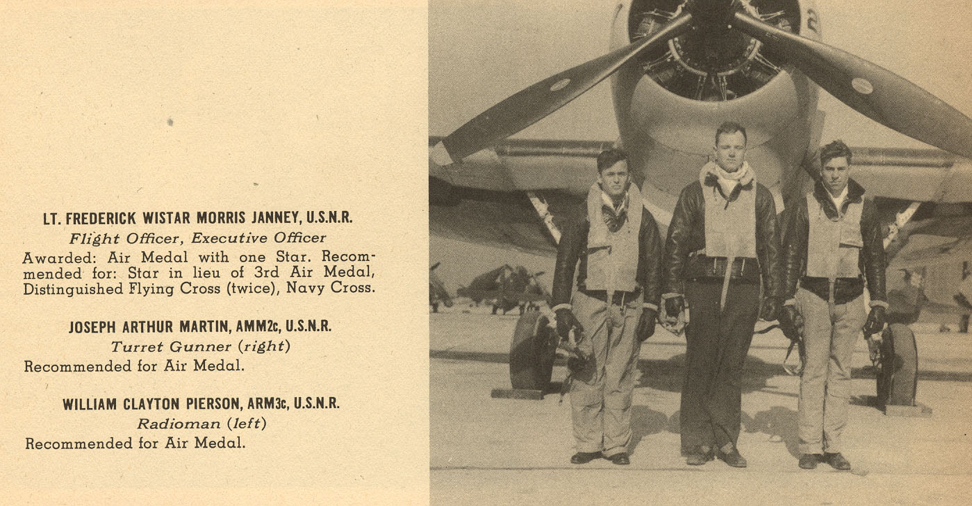
After the crash, the pilot, F. W. Janney of Philadelphia, PA, and top turret gunner, Charles W. Price of Houston, TX, managed to get out of the damaged
Avenger before it sank. However, the radioman/ventral gunner, Bernard J. Viscovich of Shamokin, PA, was trapped in the plane and
drowned.
Another eyewitness, Paul Moran, provided this account of the crash:
“I was on a sailboat near the crash site when it occurred. We had been to a marina in Houghton and were returning toward moorage between Juanita and Champagne Point. Someone aboard shouted “look at that plane!” and when I looked it was approaching the water at high speed and at a fairly steep angle. When it hit, the wings appeared to fold forward and all kinds of debris threw up spray ahead of it. A large piece of debris, which we thought was the propeller, cart wheeled across the water ahead of the fuselage. We saw what we thought to be the pilot thrown 20 to 30 feet into the air. We turned the boat around and proceeded to the crash site to see if there were any survivors. We found a person floating in his life jacket who was dazed and barely conscious. We could see another person also floating in the water some distance away that seemed to be in slightly better shape so we stayed with the first person to be sure he wouldn’t drown. We were afraid to bring him aboard because we didn’t know the extent of his injuries. We held him along side until a crash boat arrived from NAS Seattle which retrieved both persons.” (Personal Communication, December 3, 2004).
Artist’s 3D Rendering of Wildcat today:
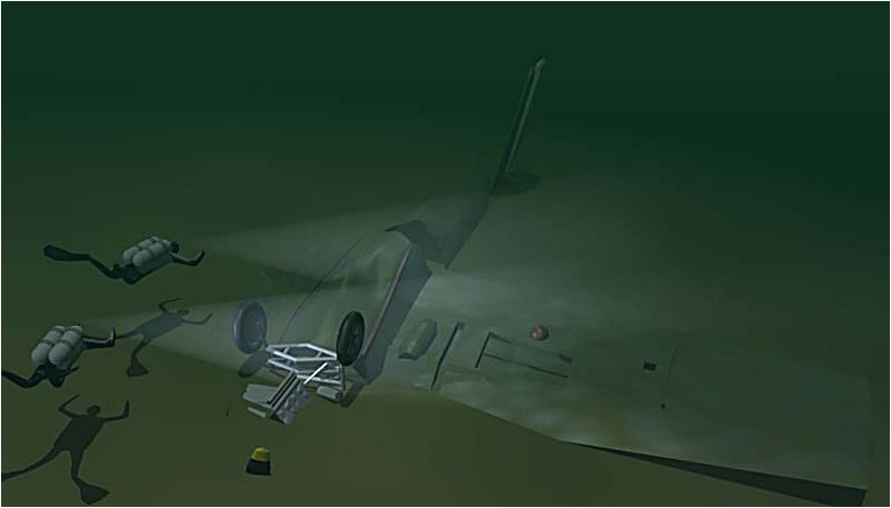
(click to enlarge)
F4F Underwater Images:
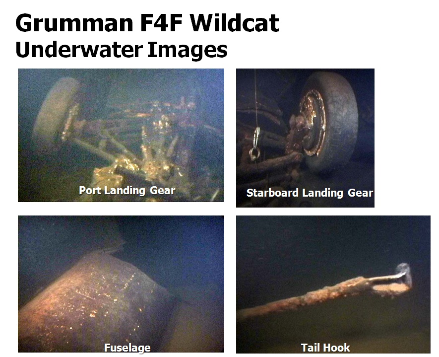
(click to enlarge)
Seattle Times, August 18th, 1942
“Planes Victim’s Body Hunted”

(click to enlarge)
Avenger Underwater Images:
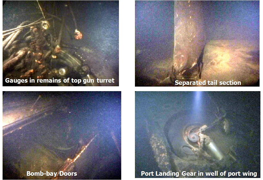
(click to enlarge)
Avenger Pilot F.W. Janney
(click to enlarge)
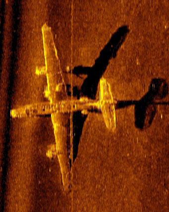
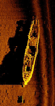
Sonar Imagery (F4F and TBF-1)

(click to enlarge)
FG-1D Corsair (Sonar Image)
Sustained massive damage as result of mid air collision. Only scattered wreckage remains.
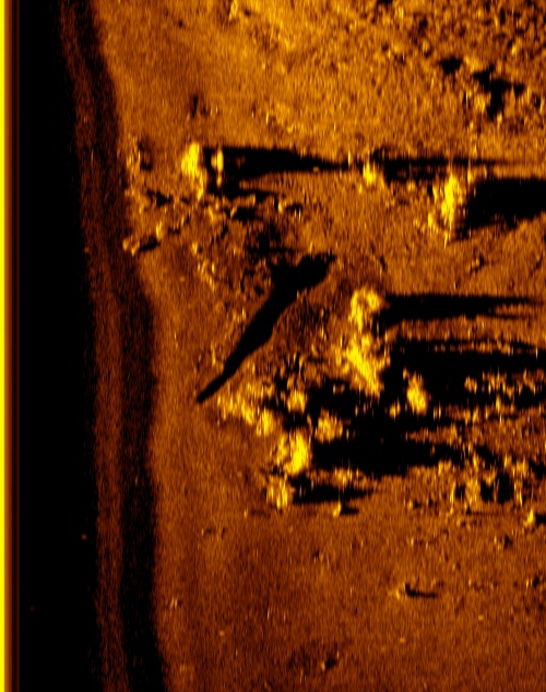
(click to enlarge)
F4F Wildcat (Sonar Image)

(click to enlarge)
PB4Y-2 Privateer (Sonar Image)
Location of SS Pacific
If you look at the post I have titled “Olympic Coast Shipwrecks” you’ll find a map that was put into distribution by NOAA and the OCNMS. In this map they mark the location of the SS Pacific. This position has long been understood as approximate because the SS Pacific has never been found.
I’ve been actively researching the location of the Pacific for a number of years. I now believe I know where the Pacific is located, but the environment where it rests is so harsh that even the best sonar operator in the world would have a tough time locating her – even if they were provided the exact coordinates of the wreck.
As skilled as I know the JaWS resources to be, I suspect this wreck may be impossible to locate. So rather than sit on this compiled data the rest of my life I am putting a high level overview of my research up for public consumption:
Overview:
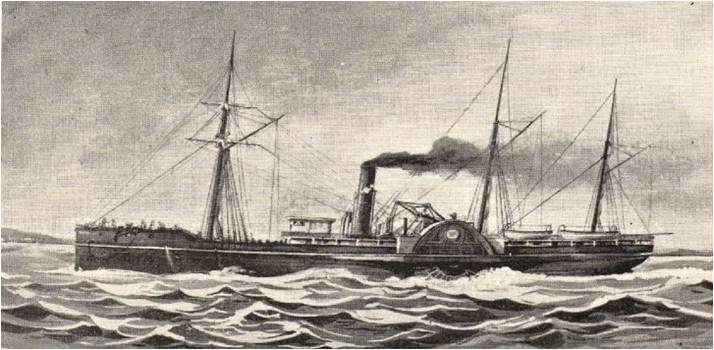
SS Pacific (side-wheeler)
876 tons
225 feet long
30 ft width
Captain: Jefferson D. Howell
Collided with square-rigger Orpheus (Captain: Sawyer) on Nov. 4th, 1875 off the coast of Cape Flattery, Washington
SS Pacific
(click to enlarge)
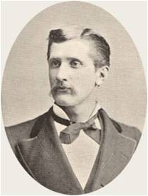
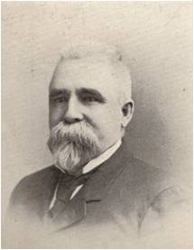
Capt Howell & Capt Sawyer
(click to enlarge)
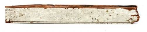
Piece of wreckage, signed: “S.P. Moody. All is Lost.”
(click to enlarge)
Cargo & Gold:
Original Print Article from 1875 reporting Cargo/Gold:
(click to enlarge)
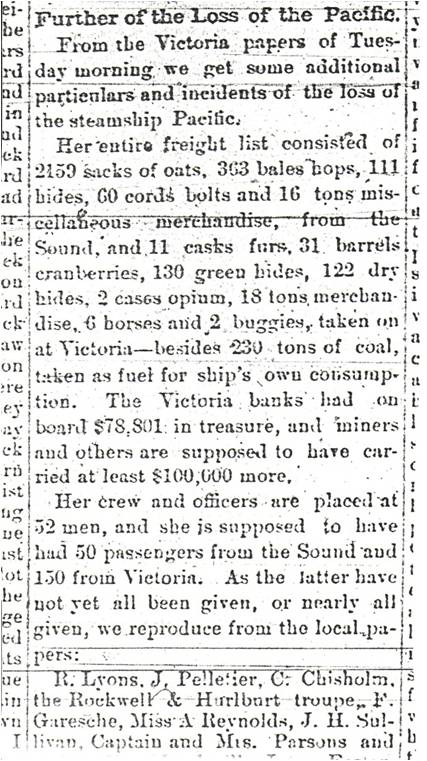
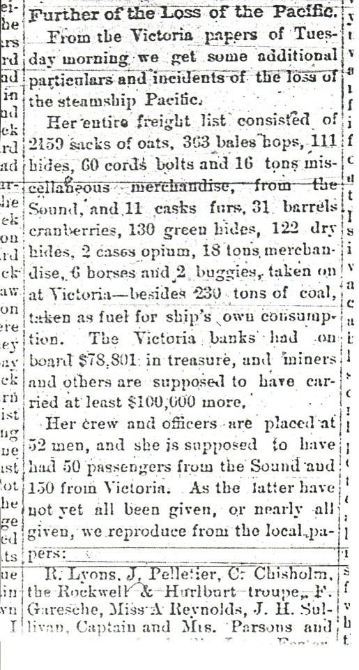
“Victoria banks had on board $78,801 in treasure, and miners and others are supposed to have carried at least $100,000 more”
“The Pacific’s safe, a Wells Fargo shipment of $79,220 in currency and gold.”
Most estimates of this treasure conclude it is equal to about 48,000 troy ounces of gold. At current gold prices of $900/ounce we’re talking about $43,200,000 million in gold. Interested?
Other Cargo:
– 2159 sacks of oats
– 363 bales hops
– 111 hides
– 60 cords bolts
– 16 tons misc merchandise
– 11 casks furs
– 31 barrels cranberries
– 130 green hides
– 122 dry hides
– 2 cases opium
– 18 tons merchandise
– 6 horses
– 2 buggies
Mapping Location:
Here is the high level process I went through in estimating the Pacific’s location:
Current Navigational Route Marked in Black
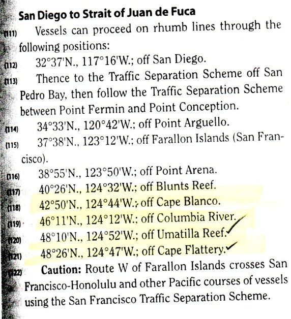
(San Diego to Strait of Juan de Fuca) :
Closely follows 3 nm contour:
46 11′ N, 124 12′ W (off Columbia River)
48 10′ N, 124 52′ W (off Umatilla Reef)
48 26′ N, 124 47′ W (off Cape Flattery)
(click to enlarge)
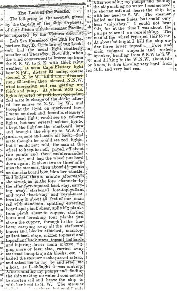
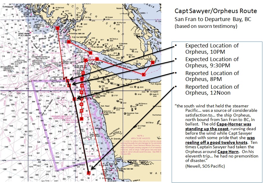
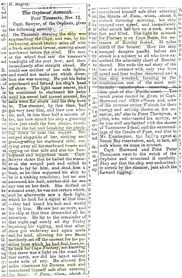
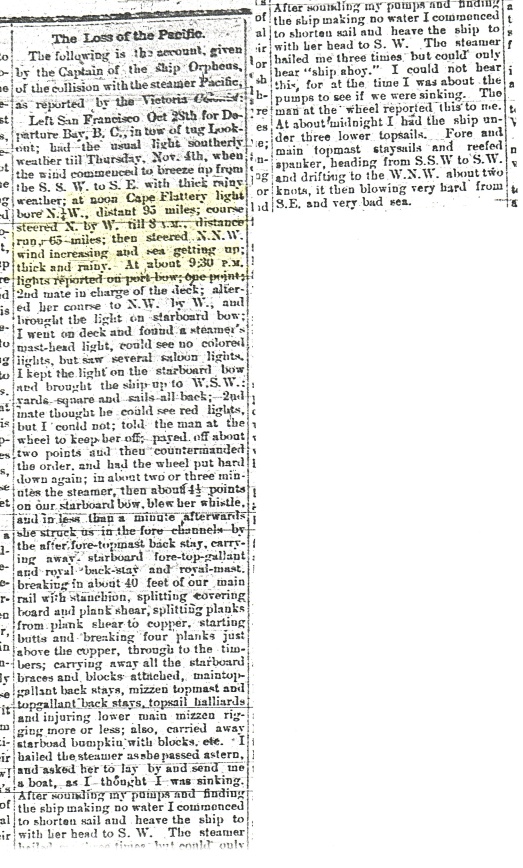
Sworn Testimony: Capt Sawyer of Orpheus (As Reported by Victoria Colonist, reprinted by Seattle Star, Nov 1875):
(click to enlarge)
“[…] at noon Cape Flattery light bore N.1/4W., distant 95 miles; course steered N. by W. till 8 P.M, distance run 65 miles [65/8=8 knots]; then steered N.N.W. wind increasing and sea getting up; thick and rainy. At about 9.30 PM lights reported on port bow; one point.”
N.1/4W = 357.18 degrees
N. By W = 348.75 degrees
N.N.W = 337.5 degrees
1 point = 11.25 degrees
Capt Sawyer/Orpheus Route , San Fran to Departure Bay, BC (based on sworn testimony):
(click to enlarge)
Expected Route, SS Pacific (Victoria to Tatoosh):
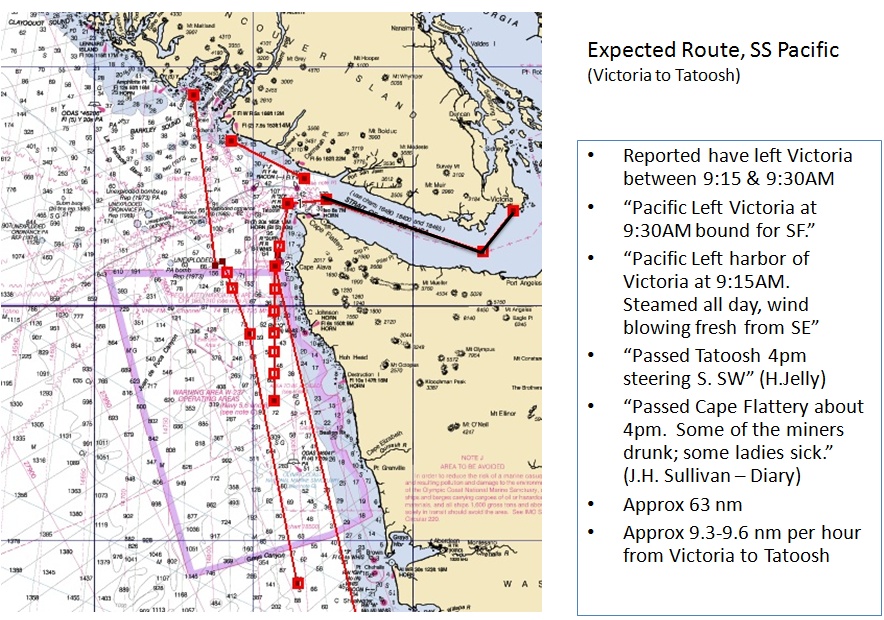
(click to enlarge)
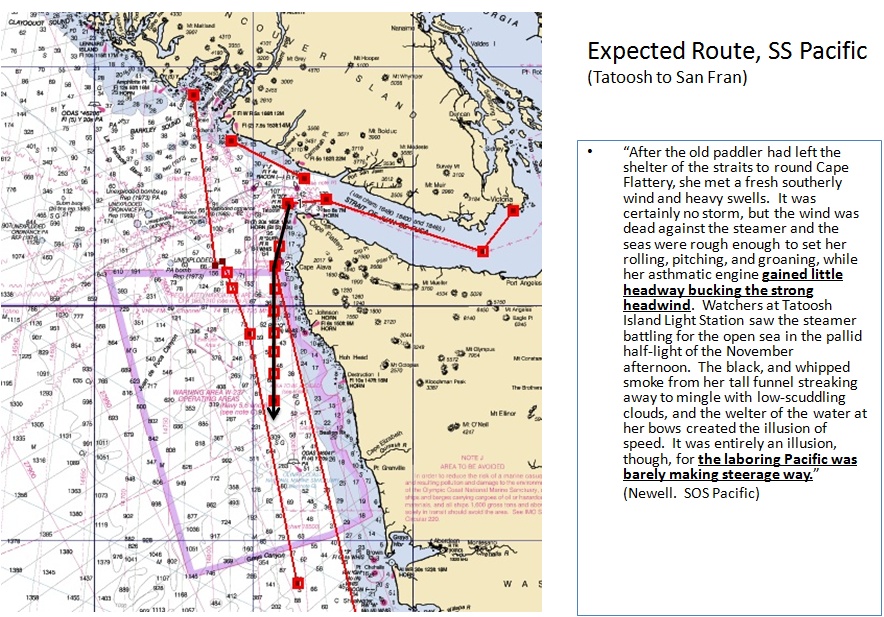
Expected Route, SS Pacific (Tatoosh to San Fran):
(click to enlarge)
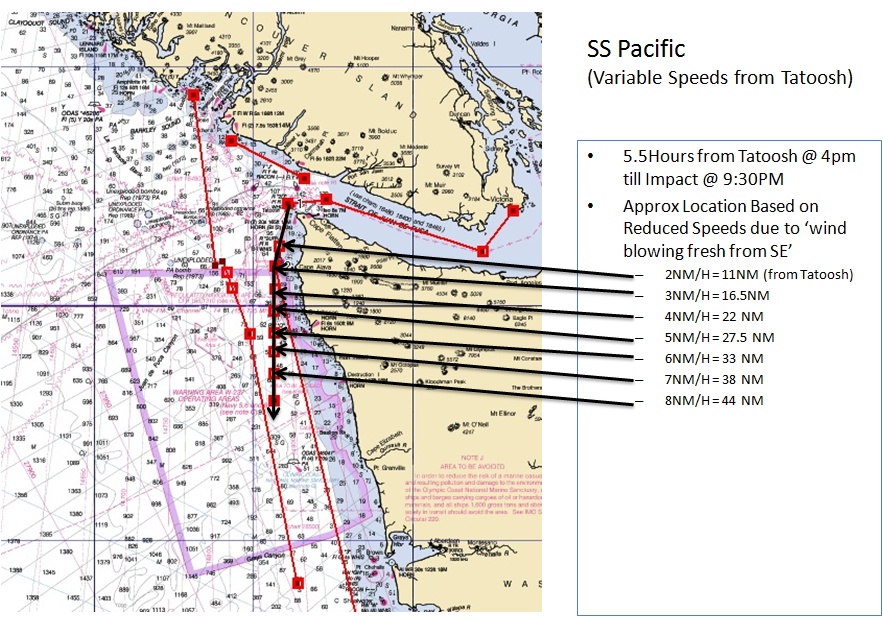
SS Pacific Route (Variable Speeds from Tatoosh):
(click to enlarge)
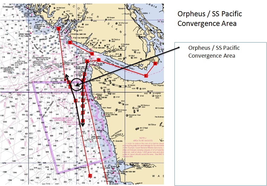
Orpheus / SS Pacific (Convergence Area):
(click to enlarge)
Area of High Probability:
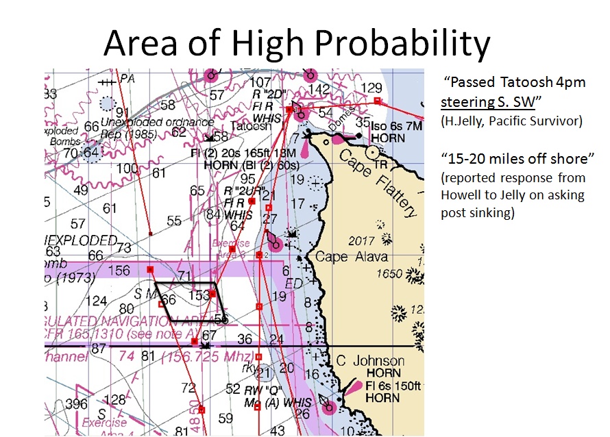
(click to enlarge)
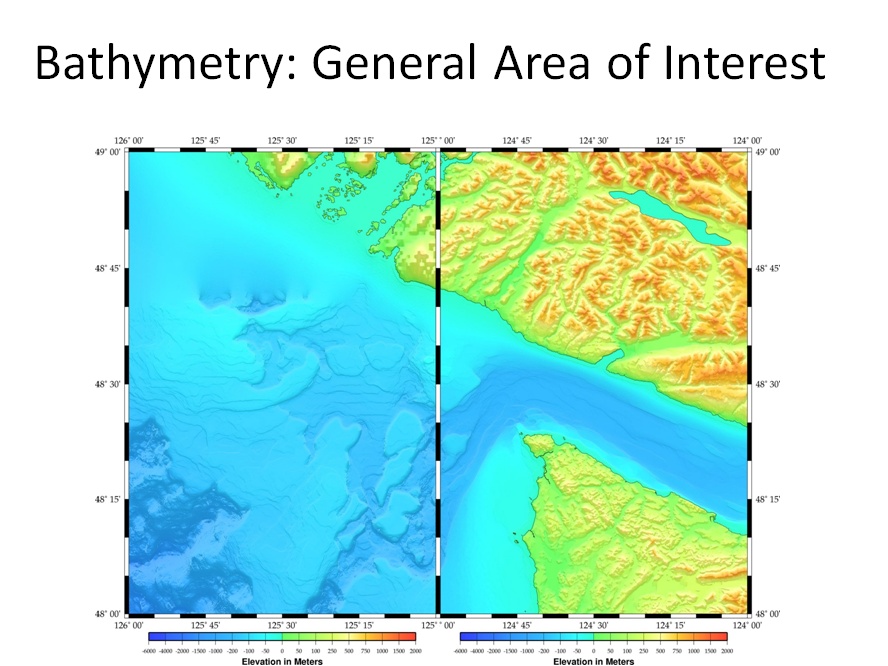
Bathymetry: General Area of Interest
Area of High Probability (with Bathy overlay):

(click to enlarge)
Final Close-Up of Expected Location (Juan de Fuca Canyon):
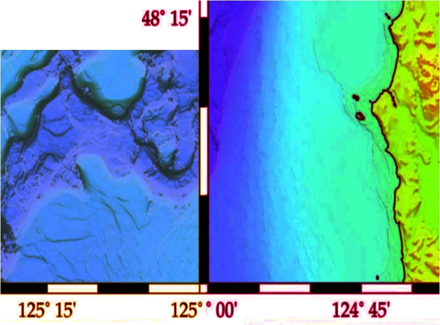
(click to enlarge)
So far as I have been able to put together, the players that are or have been involved in looking for the Pacific are as follows:
– JaWS Marine
– Odyssey Marine (note “Seattle Project” within the “shipwrecks” section of their website)
– Pacific Sea Resources (William M Mathers), who contracted a search with Oceaneering.
– Jeff Hummel
Interestingly, there is a bit of a web that ties a lot of them together:
Jeff Hummel is locally known for pulling a Corsair out of Lake Washington in 1984 and then fighting the US Navy for ownership, and winning. He is or has in the past been partnered with Bill Mathers and is reportedly required to make a yearly expedition to look for the Pacific or risk breaking one of his contractual agreements. Jeff’s current claim is that he has located a piece of coal that he had analyzed by an expert who told him it was coal from a mine near Coos Bay, Oregon. Which if true would be significant because the Pacific took on coal in Coos Bay. But while it seems possible an expert could date the coal, it seems highly unlikely an expert could tell what particular mine a piece of (130+ year old/brought-from-the-ocean-depths) coal was extracted from.
Bill Mathers of Pacific Sea Resources holds the strongest position in my opinion as he had the foresight many years ago to pre-arrange exclusive ownership agreements with the US Salvage Association, Fireman’s Fund and the American Presidents Lines. These three companies are generally accepted as the companies who could lay insurance claim to any treasure that was recovered from the Pacific.
Because of Bill’s arrangement with those organizations, Odyssey Marine negotiated an exclusive agreement with Bill Mathers. Note Odyssey’s quote on the subject: “Odyssey has reached an agreement with researchers and insurance interests that gives the company 80% of any net revenue generated by the project.” This likely means if Odyssey located the wreck they would get 80%, Bill Mathers would get 10% and the insurance interests would get the remaining 10%.
JaWS actively tried to strike an agreement with Bill Mathers as well but despite numerous discussions with Bill over the course of last year, Mr. Mathers remains unwilling to depart from the behemoth Odyssey Marine. Though I believe quite strongly Odyssey will never be back to search for the Pacific.
Why won’t Odyssey go back? Is the possibility of $40-$50 million in treasure and not having to deal with any courts other than our own not enough to allure them back? Further, why hasn’t anyone else been successful in locating the Pacific despite numerous attempts?
Look again at the bathymetry image:
My research would indicate the SS Pacific is sitting somewhere in or around that Juan de Fuca canyon, a canyon that drops quickly from 71 fathoms (426ft) to 153 fathoms (918ft). That is one hell of a steep drop in an environment of house sized boulders and high currents.
I think Odyssey has determined the wreck to be in the same location and hit the area (and surrounding area) very hard in 2003. When identified targets outside the canyon proved dead-ends, they came back to the conclusion that the wreck lies in the canyon and scrapped their plans to come back in 2004 or beyond.
Operations smaller than Odyssey (i.e. JaWS, Mathers, Hummel) may still mount expeditions to try and locate the wreck, but to be successful a very skilled crew and sonar operator are going to have to run the capital equipment risk of doing very low flybys through that canyon – and even if a capable crew comes together to pull it off, the sonar returns that will be banging off the side of that canyon are going to make it nearly impossible to discern the 130+yr old remains of a ship ravage by the collision, the sinking, the rocks, the depth and the relentless current.
Additional supporting documentation included in the post below.
Pacific Location: Additional Supporting documents
Capt Sawyer of Orpheus Account (2nd Hand):
Current Navigational Routes:
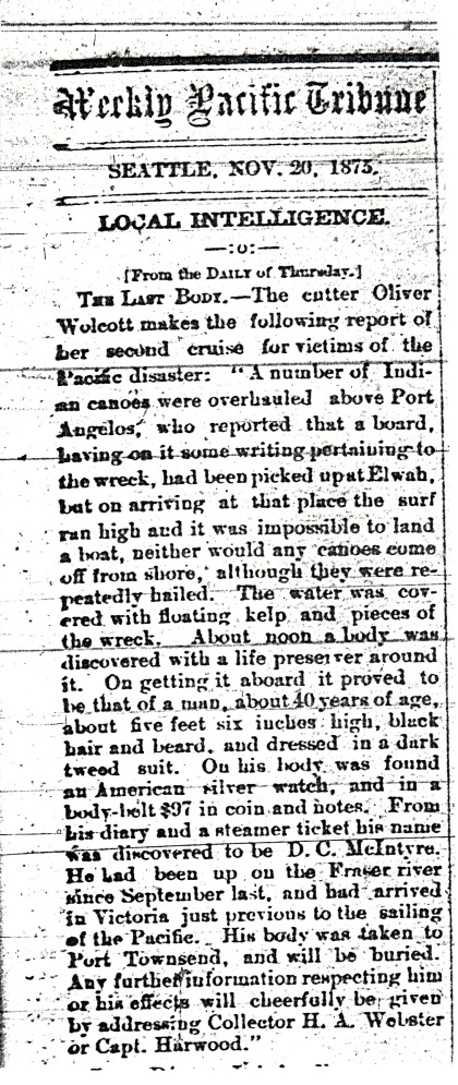
Cutter Oliver Walcott report (Weekly Pacific Tribune Nov20,1875):
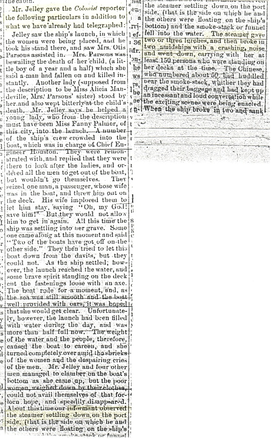
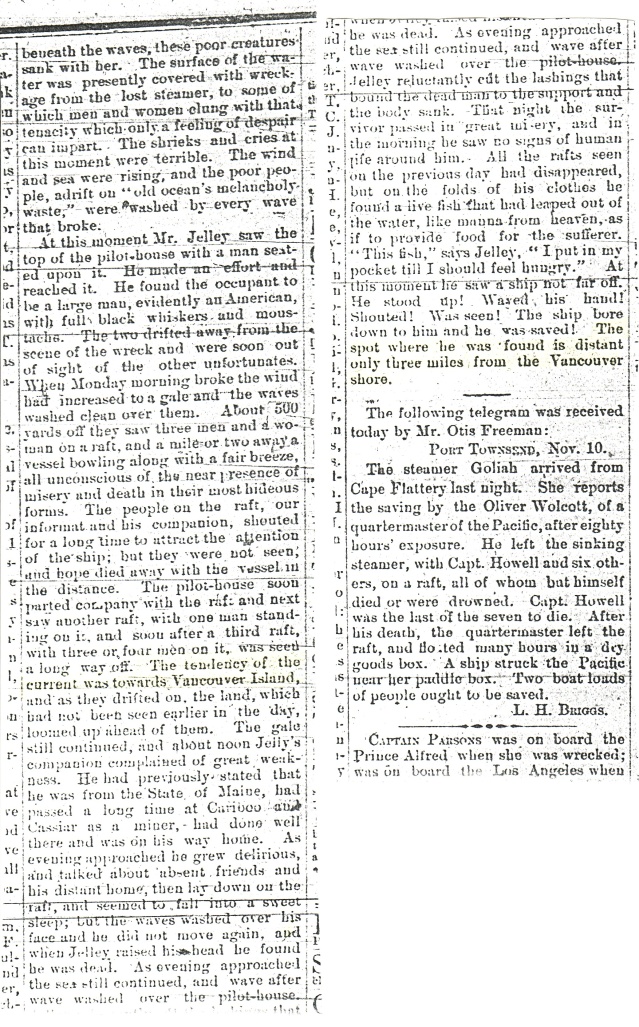
MrJelley account to Colonist part 1 and 2:
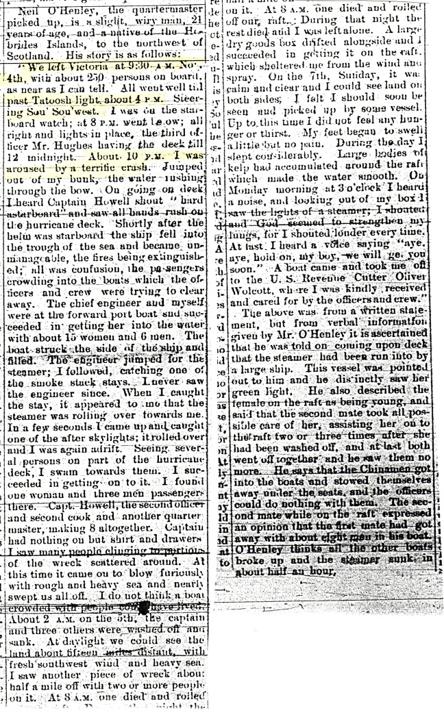
OHenly account (second survivor):

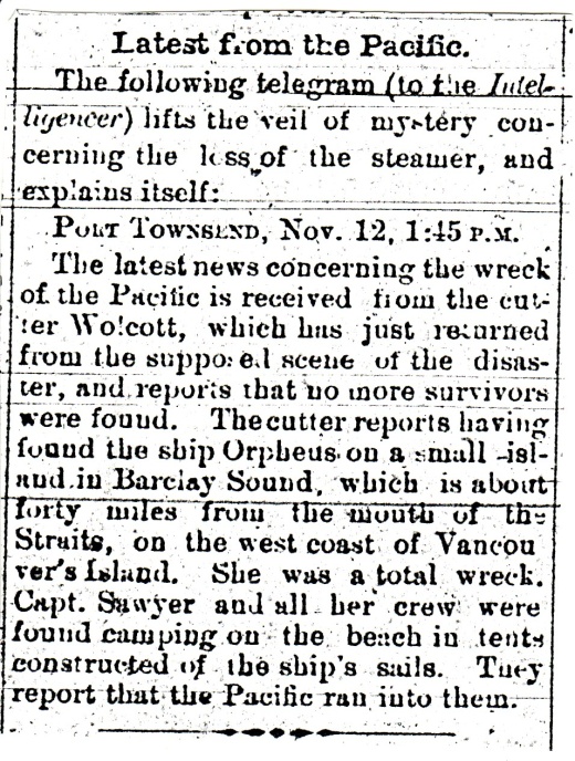
Short Telegram to Intelligencer:
SS Pacific Cargo List:
Sworn Testimony from CaptSawyer of Orpheus as Reported by Victoria Colonist:
Sworn Testimony from Crew Member of Orpheus:
Sworn Testimony from Passenger Henley of the Pacific (part 1 and 2)

One YMS Identified, Another YMS Identity Narrowed
Of the 3 Minesweepers at the bottom of Lake Washington, only the YMS-359 was positively identified since their discoveries (the YMS-359 has 359 painted on the bow).
Now the guys over at pugetsounddivers.com are reporting they have identified one of the other two minesweepers and narrowed the identity of the third.
The least intact YMS in the lake is now identified as the YMS-416.
Short history on the YMS-416:
“Laid down 9 January 1944 by the Stadium Yacht Basin Inc., Cleveland, OH; Launched 28 May 1944; Completed 21 October 1944; Struck from the Navy Register 7 February 1947; Sold 6 December 1947.” Fate (previously) unknown. At some point this one was stripped and scuttled.
The YMS we discovered most recently looks like it may be the YMS-118, -124 or -311. Here is a short history on those three ships:
YMS 118 : Struck from the Naval Register, 17 April 1946; Sold in 1951 to the Northland Navigation Co., Ltd. of Vancouver, British Columbia, Canada, rebuilt as a general cargo vessel and named Pacific Prince; Sold 31 January 1962 to Skeena Navigation Ltd. of Vancouver; Sold 31 March 1962 to the Northwest Shipping Co., Ltd. of Vancouver; Sold 16 June 1966 to Fred S. Hill and John R. Keebaum of Seattle, WA and rebuilt as a fishing boat and renamed V-O; Sunk in February 1967 in a voyage from Seattle to King Cove, AK.
YMS 124: Laid down, 4 December 1941 by the Krause and Banks Shipbuilding Co., Inc., North Bend, OR; Launched, 6 June 1942; Completed, 23 October 1942; Struck from the Naval Register, 17 April 1946. Fate unknown.
YMS 311: Commissioned USS YMS-311, 6 November 1943; Decommissioned, 31 July 1946 and placed in service as a Naval Reserve training ship; Named Robin and reclassified as a Motor Minesweeper, AMS-53, 1 September 1947; Recommissioned in February 1952; Reclassified as a Coastal Minesweeper (Old), MSC(O)-53, 7 February 1955; Decommissioned 7 December 1957 and placed in service as a training ship at Tacoma, WA; Placed out of service in the summer of 1961; Struck from the Naval Register, 1 August 1961. Fate unknown.
I tend to believe the most recent YMS to be discovered is the YMS-118 because the wreck we are diving has clearly been rebuilt into a fishing vessel. Note square windows of pilot house in prior posts – square windows are not ‘original equipment’ for any YMS as they all had round bomb-blast/porthole type windows.
The inconsistency with calling this YMS the -118 is that it reportedly sank in route to Alaska – so how did it end up at the bottom of Lake Washington?
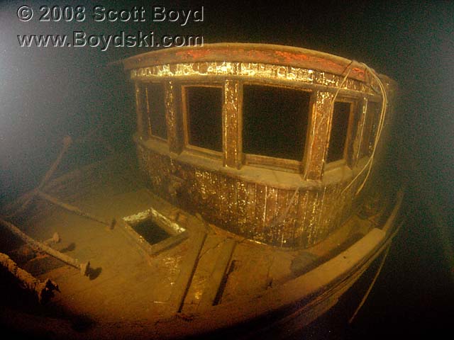
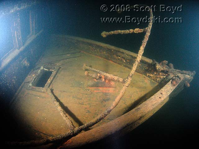
Wreck of the Fishing Vessel ‘Sonny’
In a joint effort with Scott Boyd of boydski.com we recently located a very nice 38′ fishing boat in the south end of Lake Washington.
This wreck is completely intact, which leads us to believe it foundered in some unexpected manner.
The incredible photos included here are taken by Scott Boyd who I consider one of the best underwater wreck photographers in the Northwest.
(click to enlarge)

(click to enlarge)
(click to enlarge)
(click to enlarge)
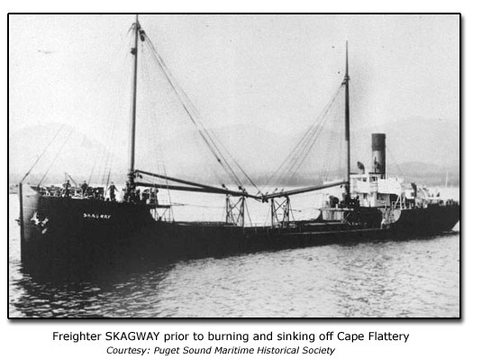
Skagway Report & Photo
From NOAA OCNMS records:
“A fire was discovered at 4:40 a.m. in number 2 hatch. Fire hoses were put in the hatch, ventilators and the steam smothering lines were turned on. Vessel was positioned on the lee side of Tatoosh Island to prevent wind from fanning flames. The vessel grounded at 6:00 am, then pulled off. The vessel was heading to sea when it was reported that she was taking on water [19′ draft]. The vessel started to list and was purposely grounded again at 8:10 a.m., and the crew was picked up by Coast Guard 9:00 a.m. and the Captain later at 1:00 pm.”
(click to enlarge)
Additional Skagway Details
Name (former): Stanley Dollar
Official Number: 205052
Propulsion: Steam
Nationality: US
Masts: 2
Age: 21
Decks: 1
Value: 150,000
Type: Freighter
Call Sign: KWNM
Use: Commercial
Home Port: CA, Los Angeles
Tonnage (gross): 1838
Built: 1908 Seattle, WA
by The Moran Co
Tonnage (net): 955
Material: Steel
Length (ft): 240.0
Cargo: Glycerine, alcohol, plaster, graphite, oils
Beam: 41.0
Owner: Skagway Steamship Co G.H. Walker
Depth of Hold: 20.0
Wreck Information
Sunk: 12/16/1929 Time: 0810
Approx Location: Latitude 48°22N Longitude 124°44W (Tatoosh Island, Fuca’s Pillar or Skagway Rocks)
LAST PORT: CA, San Francisco (12/13/29)
DESTINATION: WA, Seattle
People on Board: 26
FATALITIES: 0
CAUSE: Fire and rough weather
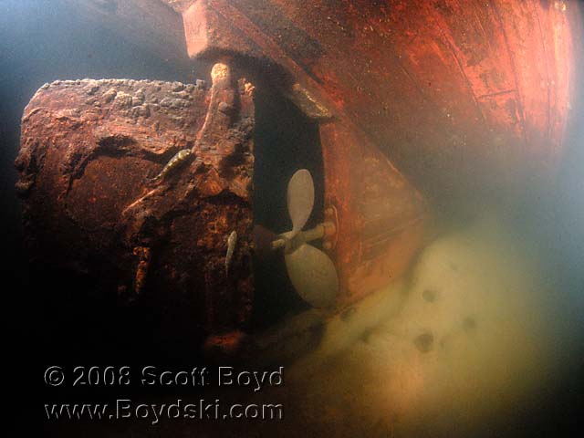
Wreck of the Skagway
The last few months I’ve been working toward becoming a certified science diver for NOAA. Later this year I am planning to take part in what is expected to be the first of a number of NOAA missions to document shipwrecks located within the Olympic Coast Marine Sanctuary. We heard recently mission planning for that trip is being centered around documenting the remains of the shipwreck Skagway.
Quoting directly from NOAA’s OCNMS website, history on the Skagway is as follows:
“The steam schooner Skagway, originally named the Stanley Dollar, was built in Seattle in 1908. Designed for the coastal trade, she was steel hulled, 240 feet long and capable of carrying 1,500,000 board feet of lumber.”
“In 1925 she was sold to the Alaska Steamship Company and renamed Skagway. On December 16, 1929, en route from San Francisco to Seattle with a cargo of glycerin, alcohol and paint, a fire broke out in the hold. As the crew worked to extinguish the flames, Captain Strandquist took the ship close to shore to avoid a strong east wind that was fanning the fire. She ran aground on the rocks just west of Cape Flattery. The Coast Guard cutter Snohomish rescued the captain and crew, but the ship and her cargo were a total loss. Afterward the captain and crewmembers exchanged bitter accusations of incompetence, drunkenness and misconduct.”
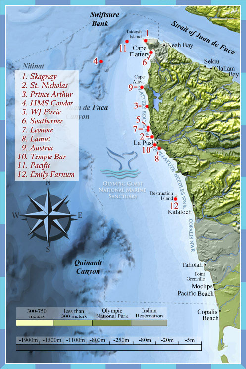
Olympic Coast Shipwrecks
Shown on this map:
1) Skagway
2) St. Nicholas
3) Prince Arthur
4) HMS Condor
5) WJ Pirrie
6) Southerner
7) Leonore
8) Lamut
9) Austria
10) Temple Bar
11) Pacific
12) Emily Farnum
(click to enlarge)
Photo of Urania after Fire
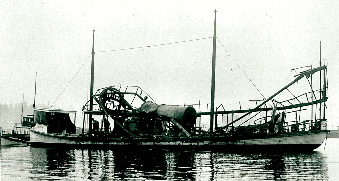
(click to enlarge)
Sonar Image of the Astorian
(courtesy of Innerspace Exploration)